Starting with
Geotripper,
others have been posting some of their favorite trees .
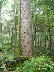
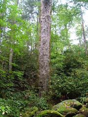
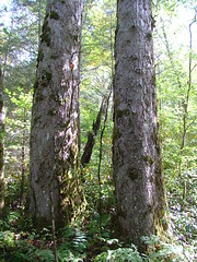
I could do an entire blog of my favorite trees, but two particular species stand out for me. First, is
Aesculus flava (Yellow Buckeye). Although I had seen the species many times before, it wasn't until going to the
headwaters of Dunn Creek in the Great Smoky Mountains during my thesis field work that I became awestruck by it. By wood volume, the tree may be in the top six largest species in the eastern US (
Tsuga canadensis,
Liriodendron tulipifera,
Pinus strobus,
Taxodium distichum,
Quercus virginiana, Aesculus flava?). When it grows in a forest situation, it develops a powerful straight bole that slowly tapers with height. Below are four +4.5 m CBH trees I found near or at my field sites.
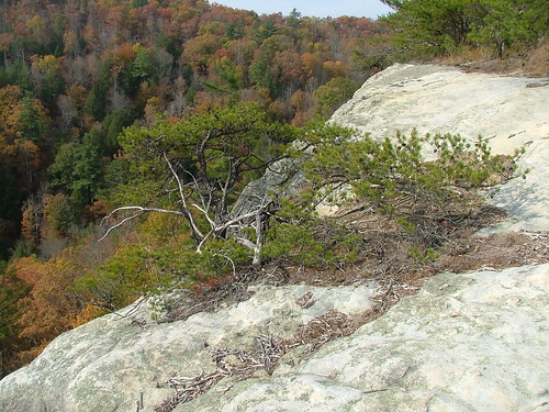
My other favorite tree has to be
Pinus virginiana (Virginia Pine). If you ever climb a rocky ridge in Appalachia, you will find it. Although it can grow on better sites, its classic home is a rock ledge, exposed to the wind and sun, growing in almost no soil. Unlike most pines that have a straight bole until they get old, Virginia pine starts out twisted and gnarly when young. When you combine the tree with its rocky and exposed homes, I imagine a tough individual that takes the worst nature can give, yet still grows and maintains a unique individuality. It is so tough, it is commonly planted on old coal strip mines where little else will grow. Below is one growing out of a sandstone ledge along the Big South Fork River.