I hear it is sand dune week, so I thought I would make a little post.
The Sand Hills of western Nebraska are North America's largest sand dune formation, covering some 50-60,000 square km. Formed during the late Pleistocene and Holocene from eolian deposits, they consist of a mixture of sand sheets, transverse, liner, and parabolic dunes. The dunes are vegetatively stabilized, but during long term droughts, reduced vegetation cover allows dune movement, primarily to the southeast. Interdune areas often intersect with the water table, resulting in lakes and wetlands. Because the sandy soil limited plowing, they mostly remained grass covered. The Sand Hills are the most ecologically intact section of the Great Plains.
Such a large feature is necessarily best viewed from above.
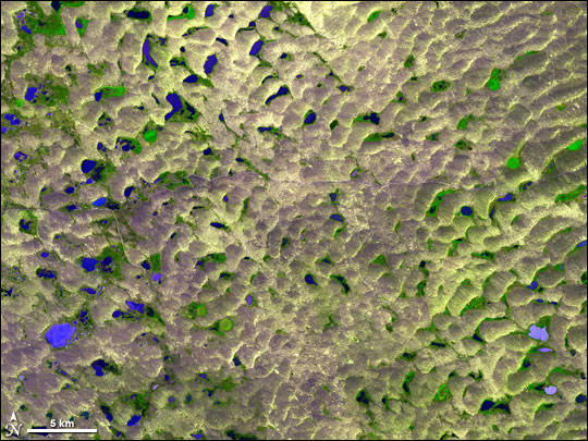 Compound Parabolic Dunes between Alliance and Hyannis
Closer to the ground, patterns are much more difficult to discern.

References
Loope, D. B. Swinehart, J. B. Thinking Like a Dune Field: Geologic History in the Nebraska Sand Hills. Great Plains Research 10:5-36. 2000.
The Sandhills
Earth Observatory Image of the Day


