It had been over a year since I last went to
Big South Fork so I thought I would go back. The geology of the area is nearly horizontal laying Mississippian and Pennsylvanian aged sandstones and shales. The Cumberland Plateau's topograph in the area is relatively flat, but becomes quite steep and rugged in streams and rivers valleys. Not only has the Big South Fork of the Cumberland River has cut a deep valley, but even small streams quickly cut down (a sample
topomap shows this clearly). This results in the
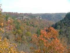
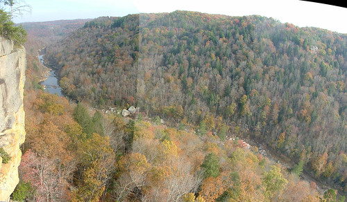
largest natural arches in the eastern US, rock-shelters, and cliffs. The first image is of the Angel Falls overlook from a ridge to the west. The next two images are of the Big South Fork from Angel Falls overlook, the third one is a panorama made with
hugin). The last one is a site with some interesting weathering.
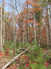
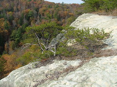
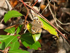
There is interesting ecology present too. Drier sites are a mixture of White Pine (Pinus strobus), Pitch Pine (Pinus rigida), Virginia Pine (Pinus virginiana), White Oak (Quercus alba), Scarlet Oak (Quercus coccinea), and under-stories of Mountain Laurel (Kalmia latifolia) as shown in the first image. The second image shows a tough Virginia Pine hanging on a cliff and the third a photogenic Common Buckeye butterfly (
Junonia coenia).
Finally, the park has many signs of past human activities, from Native American to European settlers to industrial logging and coal mining. The last image shows the house and
English-style barn built around 1900 by John Litton.


0 comments:
Post a Comment