
Desert lake and Sand Dune Field from Google Earth.
Last weekend I took a trip to Desert Lake located in the Desert National Wildlife Refuge. The lake is a large dry playa located in Desert Valley, an endorheic basin. An endorheic basin, also known as a closed basin, has no water exiting or leaving it. The valley itself is located on the southern side of the larger endorheic Great Basin. Because of the unique names of the playa and valley, I haven't been able to find much published literature about the area.
Desert Valley drains an area starting at the Groom and Tikaboo ranges near Rachel, through Nellis Air Force Range, before terminating at Desert Lake.
Although it was wetter in the area during the Pleistocene and may well have sustained a permanent lake, now the area receives less than 15 cm of rainfall a year. The frequency of induation of this playa, like most playas, is probably unknown (Lichvar et al. 2004)
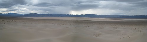
Desert Lake as seen from the dune field looking toward the southwest
There are lots of playas in southern Nevada, but desert is more unique because of its associated sand dunes. To the east of the lake is the Sheep Range, a 1,500-2,000 m mountain range of Cambrian to Devonian dolmite and limestone (Jayko, 2007). Along with predominately westerly winds, this allows the formation of a dune field.
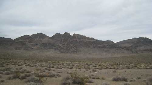
The Sheep Range from just north of Desert Lake
 This process is also illustrated on the larger and more famous Great Sand Dunes National Park. As seen in this image from the park's website, winds blow the deposited sand west until it is again deposited at the base of the mountains. Winds blowing through mountains passes from the east help to pile the sand into dunes. For much more information about the Great Sand Dunes see a recent paper in Geomorphology (Madole et al., 2008).
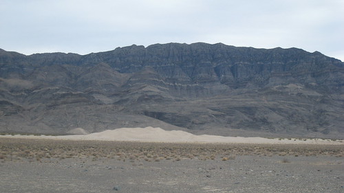
Desert Lake Sand Dune Field
I estimated the tallest dunes as > 20 m. The Dune Field covers only a few square km of land, however, the surrounding area is quite sand, but is mostly covered in vegetation. The dunes themselves are only sparsely vegetated with Ambrosia eriocentra (woolly bursage) and Chilopsis linearis (desert willow). The dune field is one of the northernmost natural occurses of C. linearis (Ackerman, 2003).

Chilopsis linearis
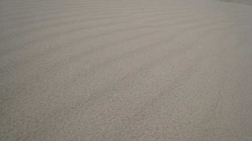
Finally, just for fun, here is a shot of some ripples on the dunes and check out geology.aboout.com's recent visit to the Kelso Dunes in California.
Ackerman, T. L. 2003. A Flora of the Desert National Wildlife Range, Nevada. Mentzelia 7:1-89.
Jayko, A. S. 2007. Geologic Map of the Pahranagat Range 30' × 60' Quadrangle, Lincoln and Nye Counties, Nevada. US Geological Survey.
Lichvar, R., Gustina, G., Bolus, R. 2004. Ponding duration, ponding frequency, and field indicators: A case study on three California, USA, playas. Wetlands 24:406–413.
Madole, R. F., Romig, J. H., Aleinikoff, J. N., VanStistine, D. P., Yacob, E. Y. 2008. On the origin and age of the Great Sand Dunes, Colorado. Geomorphology 99:99-119.
1 comments:
Man, that is some rad deltaics going on in the northern part of the Basin too...nice post!
Post a Comment