Posted by Chris M Monday, May 24, 2010

Map Monday 19: Bathymetry of Lake Baikal

Bathymetry Color Map of Lake Baikal


Lake Baikal is most famous for being the deepest and most voluminous lake in the world [assuming you don't count the Caspian Sea]. For me, the most striking feature isn't the deepest point, but rather, the average depth at 744 meter. The bathymetry, instead sloping to the lowest point, it has steep sides and a flat bottom. Image a fjord, although it isn't glacial in origin, rather tectonic. This oblique DEM gives another perspective.


Oblique Baikal


Map Information
The INTAS Project 99-1669 Team. 2002. A new bathymetric map of Lake Baikal. Open-File Report on CD-Rom

Posted by Chris M Friday, May 21, 2010

Riviére de Terre

Riviére de Terre
Riviére de Terre by Andy Goldsworthy; photo by Emmanuel Prunevieille.


This month's Accretionary Wedge is geo-images. Although, I do like maps, I went with something different.

I first learned of the land artist Andy Goldsworthy through the documentary Rivers and Tides. As the name "land artist" implies, various "natural" materials, such as rocks, twigs, leaves, soil are used in the creation and placement of the art. Many of the features are temporary, being "destroyed" by the nature around it.

The work is made of a variety of local clays, forming the work as the clays dried.

Posted by Chris M Monday, May 17, 2010

Map Monday 18: 1911 Mount St Helens

With the 30th anniversary of the 1980 eruption coming up tomorrow, why not a pre-eruption map? The below is the 1919 Mt St Helens quadrangle. Be sure to click on the image for a zoomable version of the map.

Mount St Helens 1911 Topographic Map

Map Information
U.S. Geological Survey. 1919. Mount St Helens quadrangle, Washington 1:125,000. United States Department of the Interior, USGS. Hosted by University of Washington.

Posted by Chris M Monday, May 10, 2010

Map Monday 17: North Side of the Moon

Moon North Side

Map Information
Lucchitta, B. 1978. Geologic map of the north side of the Moon. US Geological Survey. Online at the Lunar and Planetary Institute.

Posted by Chris M Monday, May 3, 2010

Map Monday 16: Vine and Matthews Magnetic Anomalies

The defining paradigm shift in 20th century earth science is clearly the widespread acceptance of plate tectonics. One of the most important lines of evidence helping to convince scientists were the existence of magnetic stripe anomalies in the rocks of the oceans. The above map, from the classic Vines & Matthews paper from 1964, shows two profiles [Atlantic and Indian Oceans]. The black is the bathymetry and the black line is the magnetic field anomaly

Map Information
Figure 1 from: Vine, F.J. and D.H. Matthews. 1964. Magnetic anomalies over oceanic ridges. Nature 201:591-592.

Posted by Chris M Monday, April 26, 2010
Map Monday 15: Cosmic Microwave Background Radiation


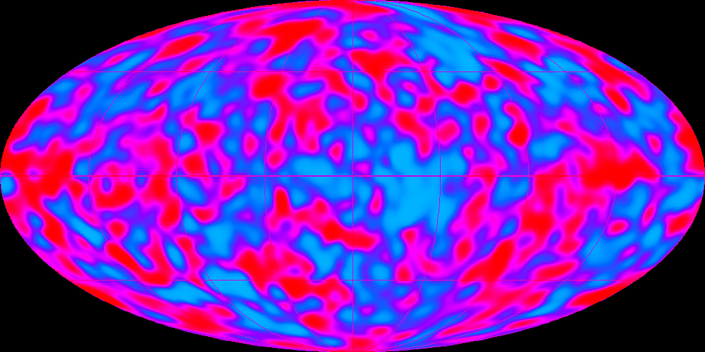
Roughly 400,000 years after the big bang, the universe had expanded and therefore cooled enough to allow hydrogen atoms to form and radiation to occur.

In 1965, Arno Penzias and Robert Woodrow Wilson of Bell Labs, found that wherever they pointed their very precise antenna they would have static. What they stumbled upon, and later won the Nobel Prize in Physics for was the experimental evidence of this relic radiation of this initial thermal radiation, now at 2.7 K.

Cosmic Background Explorer (COBE)
satellite was launched in 1989 to examine the irregularities in the radiation. 2001 saw the launch of the Wilkinson Microwave Anisotropy Probe (WMAP), to provide an even more detailed look.

These images provide "maps" of the universe and its irregularities when the universe was only 400,000 years old. These irregularities explain the present day large scale variations of mass.

COBE is the top image and WMAP is the bottom image.

Map Information

NASA Goddard Space Flight Center. 1992. CMB Fluctuations from Legacy Archive for Microwave Background Data Analysis: DMR Images.
WMAP Science Team. 2010. WMAP Internal Linear Combination Map from Legacy Archive for Microwave Background Data Analysis: WMAP Data Product Images.

Posted by Chris M Sunday, April 25, 2010

Floyd Dominy dead at 100


US Reclamation Bureau official Floyd Dominy (R) inspecting the Arghandab River Dam in Afghanistan. Taken by James Burke on February 27, 1963.

Posted by Chris M Monday, April 19, 2010

Map Monday 14: La Pama


In 1815, the German geologist Leopold von Bunch visited the Canary Islands and suggested that they were of volcanic origin. He also used the Spanish word caldera, meaning cauldron, to describe a few of the particular landforms he observed. The above is a later map of one of the Canary Islands, La Pama. The Caldera de Taburiente dominates the island and the map. The narrow canyon opening the Caldera to the southwest is called Barranco de Dolores [Valley of Sorrow] .

The topography of the island is beautifully shown using hachures. It wasn't until the mid 19th century that contour lines became the default way to show topography.


Map Information
Buch, Christian Leopold von. 1836. Carte Physique de Palma from Atlas des Iles Canaries.

Posted by Chris M Saturday, April 17, 2010
Luna Leopold

The topic of this month's Accretionary Wedge is "Geological Heroes".

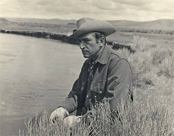
The hero I picked was the hydrologist/gemorphologist Luna Leopold. In the 1950s and 1960s Leopold, along with Reds Wolman, Arthur Stahler, and others, he helped to change geomorphology from descriptive and qualitative to a quantitative, process based science. In particular, Leopold focused on rivers, studying not only how their forms were linked to various watershed attributes [landcover, climate, etc] but how rivers respond to perturbations to these attributes. For example, how does a river's shape, width, and depth react to an increase in discharge? In the classic text of fluvial geomorphology, Fluvial processes in geomorphology, Leopold [with coauthors Reds Wolman and John Miller] wrote about comparing river meanders of different rivers
The presence of the large meanders, however, poses several problems. First, how and when were such meanders initiated? Second, why do the appear to be unusually large? Third, how are they maintained as the stream corses the bedrock? Was the meander form inherited from an earlier time when the river flowed at a higher level, perhaps on a dispositional or erosional surface no longer evident in the present topography? Or do the large meanders suggest that at one time much larger volumes of water were carried by the Susquehanna? If so, did these larger rivers provide greater energy with which to mold the larger bend in bedrock? [Leopold et al. 1964]


Leopold had a long and varied career, with almost 200 publications. These range the spectrum from remote field work on the Colorado River in the Grand Canyon, to flume work in the laboratory. He was at times the chief hydrologist of the USGS, chair of the geology department at University of California-Berkley, and president of the Geological Society of America.

Leopold, the son of pioneering ecologist Aldo Leopold, was involved with important studies on the environmental impact of human development. A study of the possible impacts of a jetport to be built in the Everglades helped to stop it from being built.

Like his father, he as spoke about our interaction with the environment and our ethical obligations to it.
Speaking of the Persians who dominated Asia Minor in the 5th century B.C., Herodotus said, “They never defile a river with the secretions of their bodies, nor even wash their hands in one; nor will they allow others to do so, as they have a great reverence for rivers.” It is the last phrase that deserves our attention. The river is like an organism; it is internally self-adjusting. It is also resilient and can absorb changes imposed upon it, but not without limit. The limit beyond which a river cannot adjust is well illustrated by some of the effects of our national program of channelization, in which we have already dredged, straightened, channelled, revetted, trained, and “improved” more than 16,500 miles of river channels in the United States, quite apart from the thousands of reservoirs already built.....

Man’s engineering capabilities are nearly limitless. Our economic views are too insensitive to be the only criteria for judging the health of the river organism. What is needed is a gentler basis for perceiving the effects of our engineering capabilities. This more humble view of our relation to the hydrologic system requires a modicum of reverence for rivers. [Leopold 1977]
Most of his publications can be downloaded from the Virtual Luna Leopold Project

Sources:

Leopold, L., Wolman, G., Miller, J. 1964. Fluvial processes in geomorphology. W.H. Freeman and Company, San Fransisco.
Leopold, L. 1973, River Channel Change with Time: An Example. Geological Society of America Bulletin. 84:1845-1860.
Leopold, L. 1977. A Reverence for Rivers. Geology. 5:429-430.

Posted by Chris M Thursday, April 8, 2010

Photographs from the past few months

Coachella Valley
The north end of the Salton Trough in the Coachella Valley. San Jacinto Mountains in the background, center. The Indio Hills - San Andreas Fault are barely visible in the valley.

Painted Desert
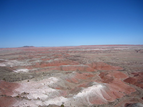
Badlands of the Painted Desert in Northeast Arizona

El Capitan
The famous El Capitan, Permian reef structure. Brian Romans of Clastic Detritus has much more information about this place.

Padre Island
The foredune crest, of the barrier island, Padre Island.

Lot more photographs.

Posted by Chris M Tuesday, January 5, 2010

Ripped from the Headlines (100 years ago)

The New York Times has a cool feature where you can read selected old papers online for free (you have to pay to see all the papers). On the front page, 100 years ago (5 January 1910), is a story entitled 'Mother Earth Still Young'. The article gives the details of a lecture by William Morris Davis.
"We are now able to tell almost exactly the age of this earth," said Prof. William Morris Davis of Harvard in a lecture at the Lowell Institute. "It has existed 60,000,000 not 100,000,000 years. We are able to tell this by an examination of the cliffs in Arizona and Utah, where the time taken to lay down deposits can be easily computed."
Sure he was off by roughly 2 orders of magnitude, but he was on the front page!