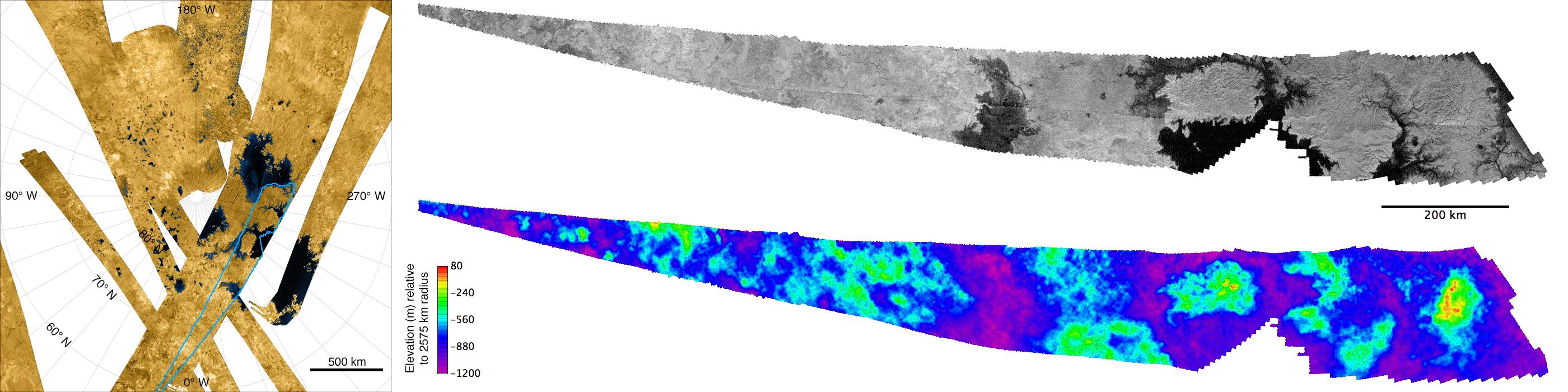
So the first two weeks have been 19th century maps. Why not something much more recent? The above image are elevations of Titan (on of Saturn's moons) obtained by the Cassini space probe in 2007. The top half is a radar scan of part of Titan's north pole. This has been converted into a DEM and transformed into a topographic image of elevations on the bottom half. You really need to click on the image to get a good view.
0 comments:
Post a Comment