The further back into the earth's past you go, the less material exists and the harder it becomes to reconstruct the paleogeography. This makes understanding the creation of the cratons, the stable cores of continents, especially difficult. Although parts of the North American craton were cleaned of covering sediments by glaciation, some parts were further buried. However, techniques such as magnetic and gravity mapping allow us to glimpse what lies under covers of sediment and rock.
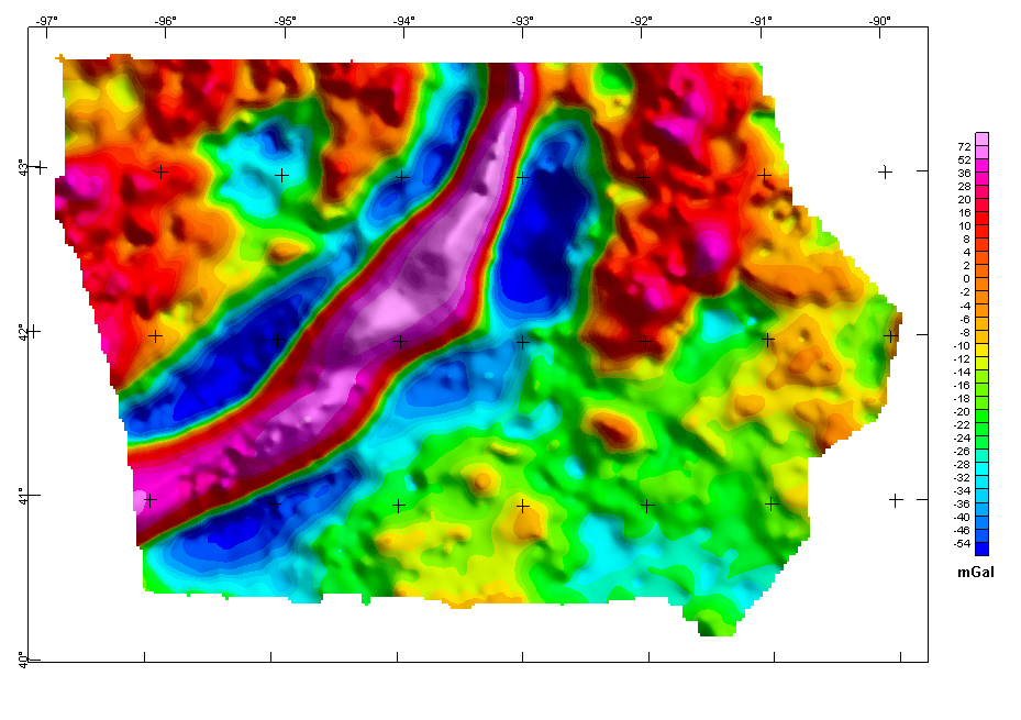
Above is a isostatic gravity map of Iowa. Locations of higher gravitational acceleration (recall g=mG/r2), are locations of denser rocks (oceanic rock), locations of lower gravitational acceleration are less dense rocks (continental). On the above map, red is higher acceleration and blue is lower acceleration.
The most obvious feature is the three "stripes" across central Iowa, consisting of a central high gravity stripe, and surrounding lower gravity stripe. The central high gravity stripe is the buried remains of the failed midcontinent rift. Roughly 1100 million years ago, the North American craton tried to rift, causing the stripe of heavy basalts, which were thrust up as the Iowa horst. The surrounding five basins were filled with lighter clastic sediments. The rift failed, but the gravity differences remain after 1100 million years.
Map Information
Iowa Isostatic Gravity Anomaly Map. From Iowa Magnetic and Gravity Maps and Data: A Web Site for Distribution of Data. Kucks, R. P. and Hill, P. L. USGS Data Series 135. 2005.
0 comments:
Post a Comment